Been hearing about some of the newer Buffalo River Trail (BRT) located down southeast of Yellville, Arkansas. Heard it was a nice place for a hike, not too difficult, and had some great views of the Buffalo River. So, this past Friday I decided to give it a hike, and I found it was all it had been hyped to be.
To get there from Yellville, just take highway 14 south till you reach the bridge over the Buffalo River. The parking area and small picnic park and canoe landing around the bridge are known as Dillards Ferry according to the signs there and the National Geographic Trails Illustrated map of the Buffalo National River East I had with me. At the beginning of my quest, I had no idea that the trailhead started under and about 50 feet to the west of bridge. The trail is not marked on my map which was revised in 2009, and what I had read about it said the trailhead was actually on Spring Creek Road. So, instead of starting at Dillards Ferry, I traveled 4 miles on down the road southeast on 14 till I saw the signs pointing the way to Spring Creek Campground (3 miles in to the west). At around 2 miles down the road on the right is the trailhead marker pointing the way up the trail 6.1 miles to the Buffalo River bridge. There is no parking area at the trailhead, so I pulled as far off the road as I could get and headed north down the trail.
I might mention that the trail also takes off to the south just across the road from the part of the trail I hiked. There is no sign saying where or how far that part of the trail takes you, but I’ve heard rumors it heads south along the Buffalo River, bends with the Buffalo to the northwest, and ends at Maumee South campground. Looking at my map I would guesstimate the distance at between 5 and 6 miles. That will be a hike for another day.
Back to the hike I took. It had been some time since I hiked in the summer, so I had kind of forgotten about some of the less pleasurable aspects of hiking along the BRT in the warm season: cobwebs and horse flies in abundance. I’m just thankful I was in good enough shape to be able to hike most of the trail without having to open my mouth to breath. You see, I had forgotten my bottle of Tabasco, and cobwebs without a little spice are very bland.
That said, the rest of the experience was well worth the bothers brought by the webs and the flies. For one, the trail is probably in the moderate range of difficulty as BRT goes. Heading north on that section of trail, most of it is not challenging making for a relatively easy hike. There is one climb, though, that begins just about as soon as you cross Kimball Creek that takes you up the mountainside to the top of a little bluff. From there the trail meanders along mildly sloping uphill for a ways before gradually winding back down the the slope and hooking into an old road shown on my map as “Tie Chute Road.” At that point, I took a turn to the right, and about a half-mile later I was at the bridge/highway 14. On the way back to Spring Creek Road, there are the inevitable stretches of uphill, but the only one of any significance comes during the last mile to mile-and-a-half of the trip. There’s a stretch in that part of the trail that used to be an old road, and for about a quarter to a half mile there is a nice little uphill grade to traverse.
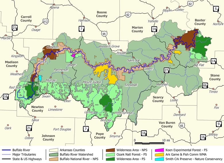
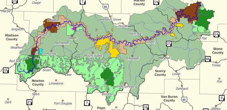
Image via Wikipedia
Almost all of the trail is well shaded by the canopy of the hardwoods, and the vegetation all along the way is lush. There are a handful of water crossings, but only one of those (Kimball Creek) resulted in me getting my feet wet. I’ll bet if I had wanted to take the time to explore up or down the creek, I would have found a place to cross on the rocks and could have easily stayed out of the water. Recent rains had caused the creek to be up, but where I crossed left me wondering how it had ever deserved the ‘creek’ designation. It was certainly not wide — about a two stepper — but just wide enough that I could not jump from one side to the other. Looking at the map, the creek itself is only about 2 miles from source to river — more of a drainage in my books.
The high points of the trek? Well, there were several nice views of the Buffalo from up high, and those views helped me gauge my route on the map. There was plenty of solitude; not another person was on the trail, but every once in awhile I could hear folks talking while paddling down the Buffalo in their canoes. Got to see a couple deer and one turkey, several other species of birds, a bunch of big snails inching their ways across the trail, butterflies of all sorts, and a very nice rain storm. I love to hike in the rain, especially when I am up high and can see out across large areas and watch the wind blow the rain into patterns as it falls. The downside of the rain was that it came to an end, and when it did and the sky cleared, the woods turned into a sauna.
Would I recommend this section of trail? You bet! If you like solitude, the sounds of nature, the lushness of the forest, and only moderately challenging terrain, this is a nice hike. Not too tough, not too easy, and certainly not boring. Oh, and did I mention, it is beautiful!
I’ll let you know how the other half of the trail is once I bag it, but till then, hike on and enjoy every breath of life you can take.
Phil
Sounds wonderful. Keep up the good hike.
Hey, thanks for the encouragement! Without any doubt, I will keep up the hikes. Got plenty more planned for the near future.