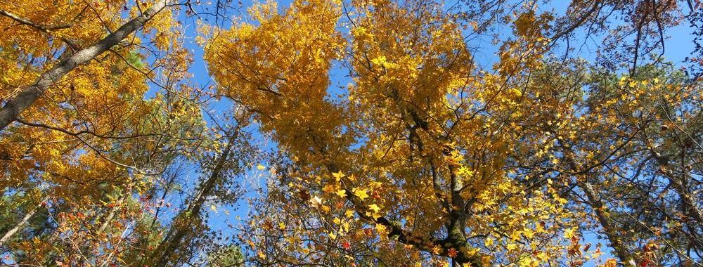
And The Hikes Go On . . .

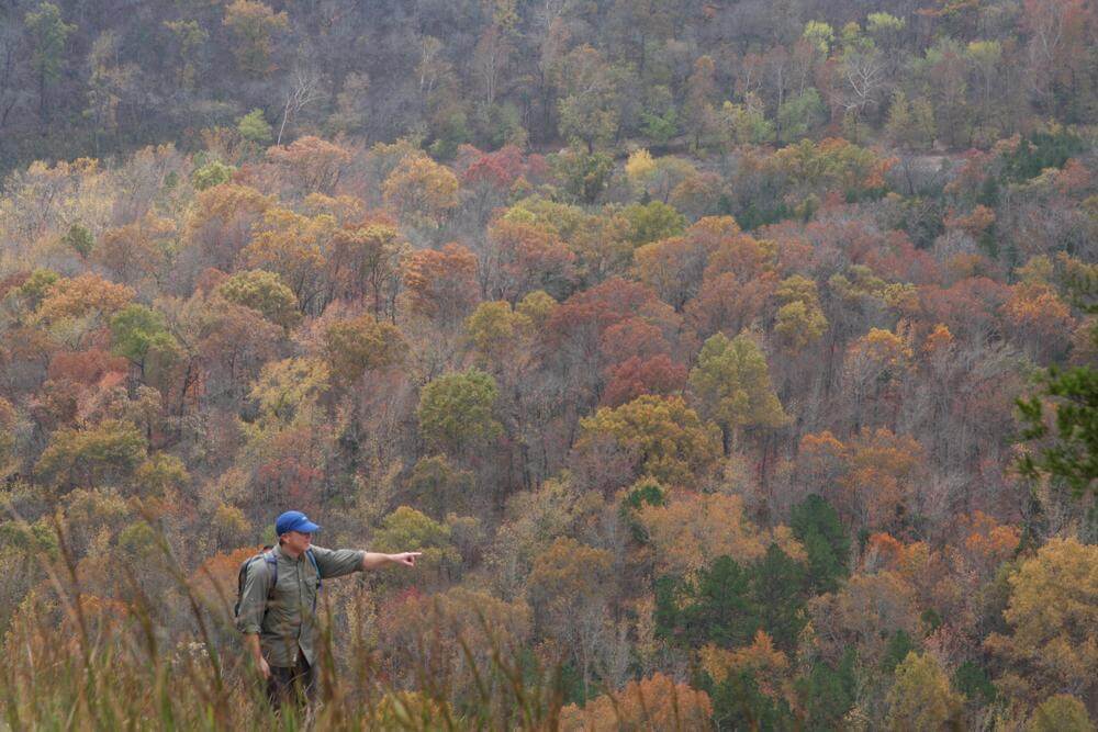
Some Hiker Dude Along Toney Bend on the Buffalo River
Zina Hall–October 6, 2011

Having posted not one thing since mid-September, one could easily develop the impression that hiking has not been happening in this neck of the woods. Oh, but it has! In October, Tom and I managed no less than three dayhikes down into where else but Leatherwood.
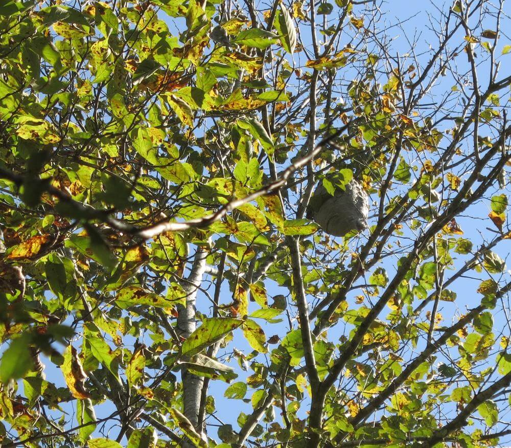
Bald-faced Hornet’s Nest
Tom Walden–November 13, 2013

In November, the pace did not slacken and even included an overnighter for the two of us. Then came turkey day when most everyone feasts themselves into oblivion. In a departure from the ordinary, Thanksgiving Day marked the start of a four-day solo journey for me into, once again, Leatherwood Wilderness.

So, one might ask, what on earth is it that motivates Tom and I to journey repeatedly into that particular wilderness area? The answer is simple: Our goal has been to explore Leatherwood up and down, side to side. And to this point, we have barely made a dent on the North and South Prongs of Middle Creek. Even more, we have yet to leave a boot print in the Short Creek and Leatherwood Creek sections, but you can rest assured, the day is a coming.
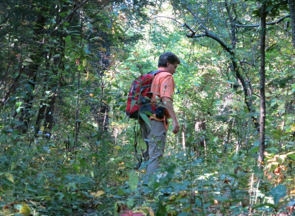
Tom, Lost on the Farris Ridge Trail
Tom Walden–November 13, 2013

One of the things that never fails to awe me about the Arkansas woods is how the leaf on and leaf off seasons affect the senses so very differently. This year, finally, I had the good fortune of experiencing each season and the transition between the two more so than I have in a several years. Without a doubt, it was exhilarating to witness the green of summer’s flora as it transformed into the stunning colors of fall. For me, however, Leatherwood reveals it’s most stunning scenery when the hardwoods bare it all. Once all the leaves have hit the turf, the curtain opens on magnificent vistas and the boldness of the bluffs that line every creek and hollow.
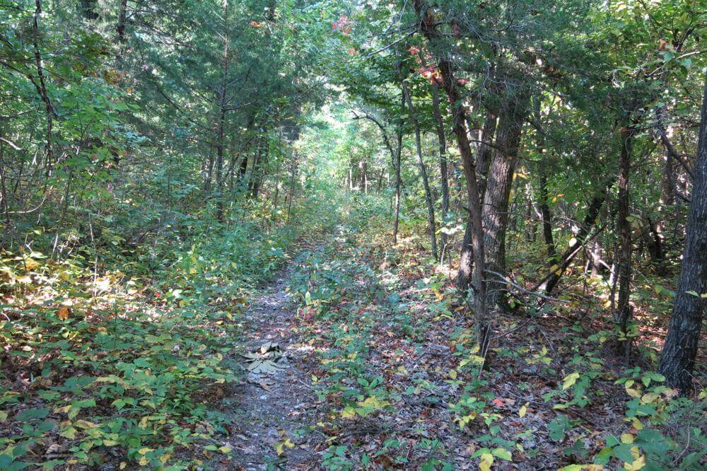
Farris Ridge Trail
Tom Walden–October 13, 2013

With the departing of the green, one learns just how secretive mother nature can be. For instance, Tom and I hiked into Leatherwood via the Farris Ridge trail numerous times during the past few months. Nonetheless, we had no idea until after the leaves dropped that we had walked time and again within just a few feet of the large, gray, paper nest of what, based on my research, I believe were Bald-faced Hornets—dolichovespula maculata. What I do know is that I’m probably fortunate to have been stung only once on all the hikes we’ve taken in the past three months.
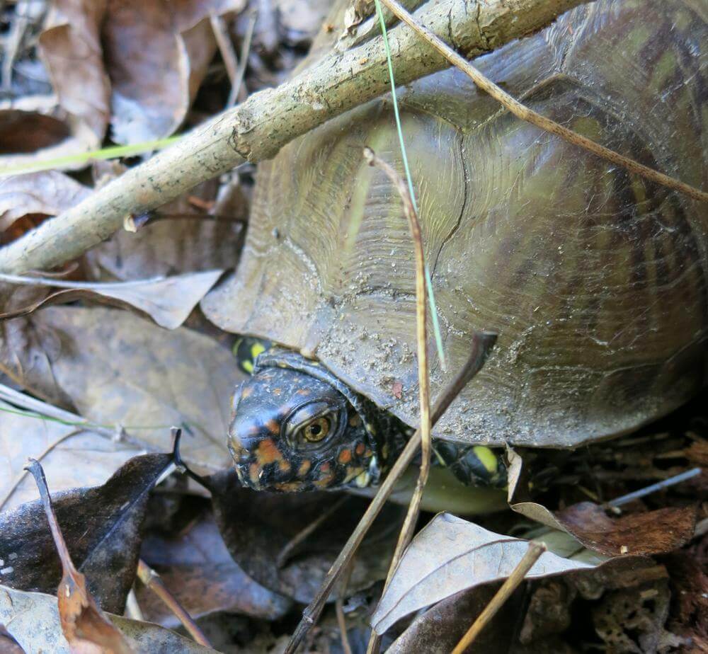
Turtle Time Along North Prong in Leatherwood
Tom Walden October 13, 2013

Certainly, Tom and I ran across a group of horse riders about a month and a half ago, and they told us that on a ride they took a day or so earlier, some of the riders and their horses were stung. I had the good fortune of getting to talk for about an hour with the leader of that group of riders on the second morning of my Thanksgiving holiday four-day solo journey, and she confirmed the occurrence of the stings and noted that her horse didn’t enjoy the experience one bit.

Well, enough about the wasps and on to all the other things we’ve encountered on our hikes. Of course, the fungi continue to amaze. They come in all colors, shapes, and sizes, and I am still unable to wrap my mind around how something so seemingly delicate can grow itself right out of the trunk of a dead, fallen tree or up through the dense pack of leaves, twigs, and pine needles on the forest floor.
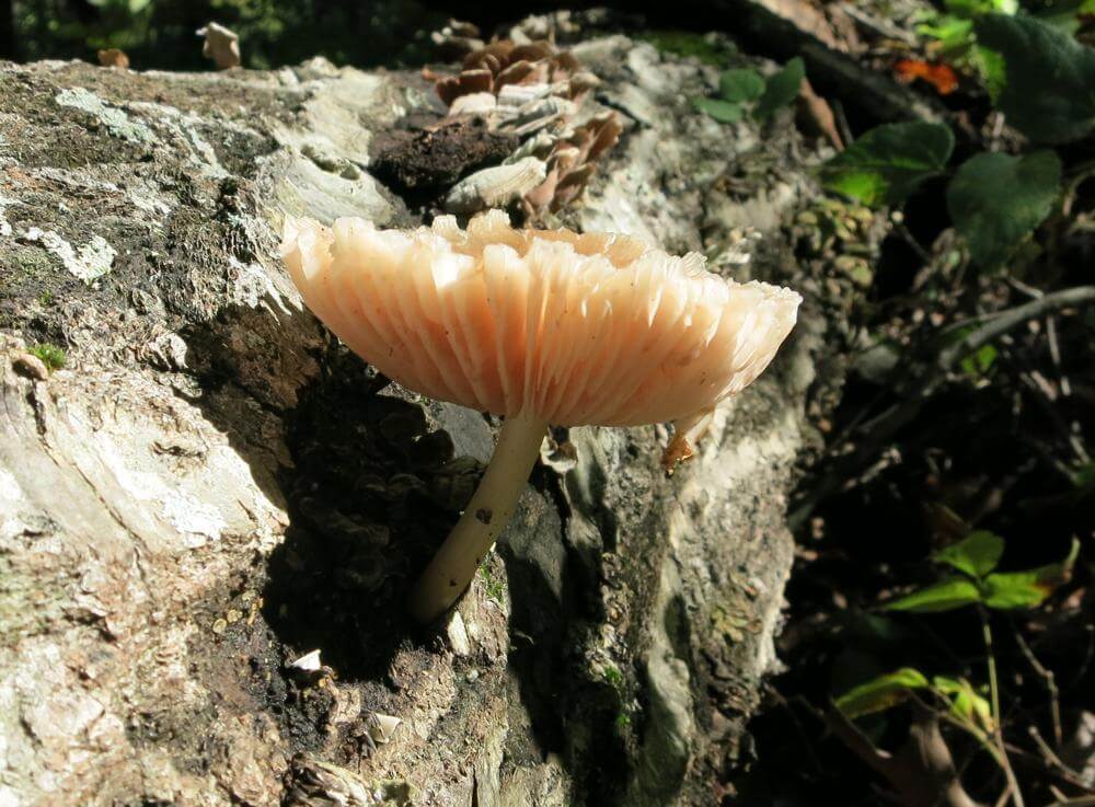
The Dead Yielding Life on Griffin Ridge in Leatherwood
Tom Walden–October 6, 2013

Of course, fungi are not all there is to the biota of the wilderness. There are insects of all sorts along with their eggs or nests. In addition, it is not all that uncommon to encounter a snake, and of course, birds, deer, bears, fox, bobcats, coons, skunks, armadillos, wild hogs, and spiders—many spiders of all sorts—to name just a few members of the fauna. Strangely enough, there have been very few webs built up high enough for one to get a good taste of them while hiking this year. Certainly, I’ve never seen anything like it during previous seasons. Typically, hiking through the Arkansas woods in the summer and early fall yields a steady stream of web events, and no, webs do not taste like chicken. As for the constructors of those webs, I am glad to say I have not had the inopportune experience of savoring their flavor.
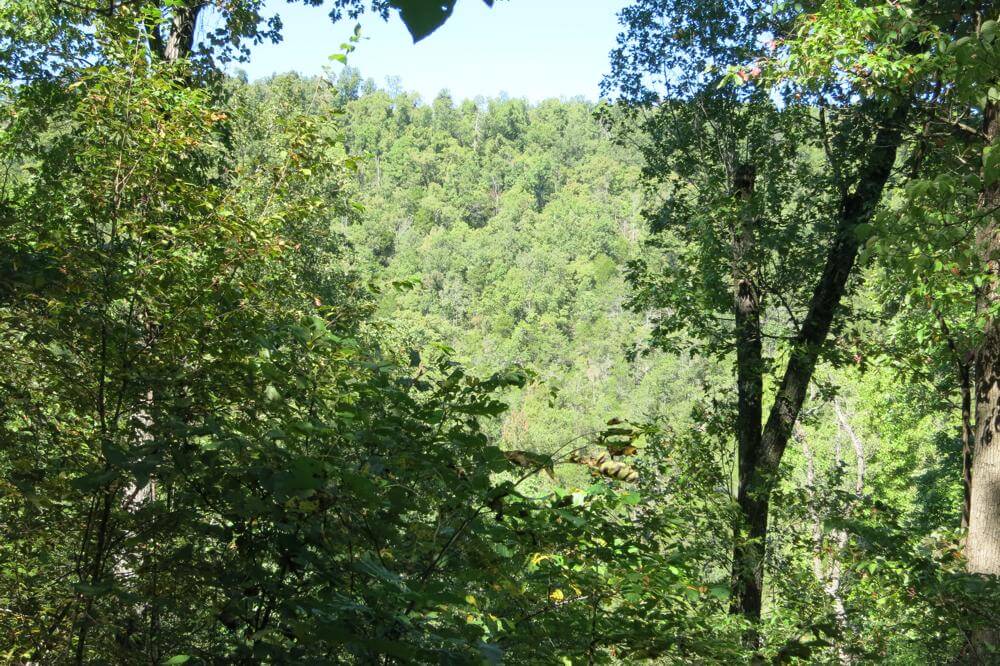
View of Farris Ridge from Griffin Ridge in Leatherwood
Tom Walden–October 6, 2013

Getting back to last weekend’s four-day event, I had the wonderful fortune of hearing the choruses of geese as they flew overhead at all times of the day and night. Those were not the only vocalizations, though. Each night, usually more than once a night, the coyote choir struck up in crystal clear fashion. The first night out, it started with what sounded like a dog barking not far from camp. But after a few sharp yips, the canine calls turned into the distinct howl of a coyote. In seconds, the whole valley lit up with howls from every direction. If you have never had the good fortune to partake of such an experience all alone at night deep in the forest, I highly recommend getting out there and introducing yourself to it—it is spectacularly eerie to perceive.
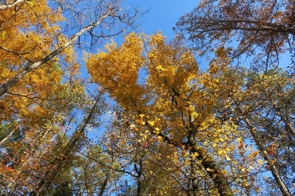
In Awe of the Fall Along Near Harrington Knob in Leatherwood
Tom Walden–November 3, 2013

While I’m speaking of the sounds of the forest, I was sitting in camp drinking my tea and reading during my final morning out last weekend. Suddenly, from off in the distance I started hearing the clucks, putts, gobbles, cackles, yelps, and purrs of wild turkeys. Repeatedly, I scanned the area around me, but the fowls producing the sounds never showed themselves. As time rolled by, though, it was clear they were moving ever closer. Suddenly, in the woods across the creek from where I sat—and still out of sight—erupted the loudest simultaneous display of turkey talk I have ever had the good fortune of experiencing. It was truly a cacophony to behold. Unfortunately, in what was probably a little less than a minute, it ceased abruptly. The quiet of the woods prevailed.
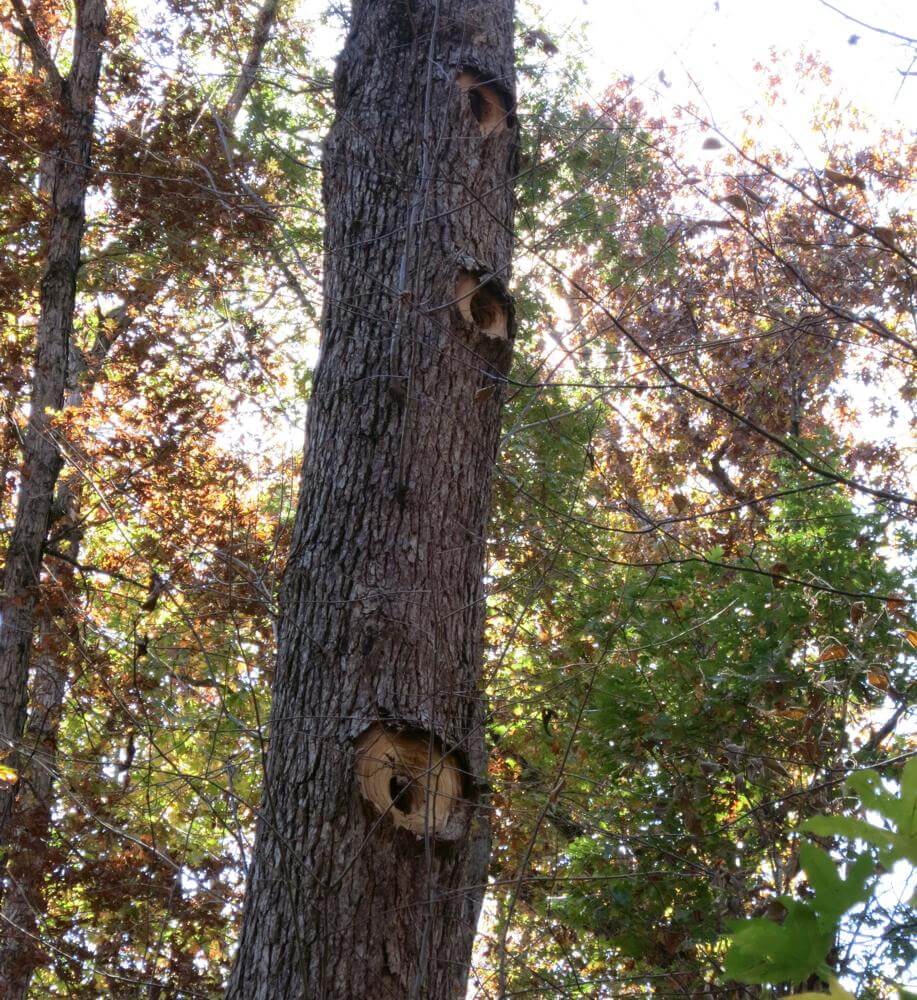
Bird Condos for Let Near Harrington Knob in Leatherwood
Tom Walden–November 3, 2013

Oh, yes, before I forget, did I mention I was stalked? Don’t know what it was, but I’m pretty sure some critter not very large in size was piqued with curiosity about the new addition to the area. It was my first night out, the clock showed about 5:30 in the evening, yet it was dark as could be. I had just nestled into the warmth of my sleeping bag when the silence of the night was broken by the faint crackle of leaves a few yards from my tent. At first I thought I was hearing things, but after laying as quietly as possible for a few seconds, there was yet another similar sound followed in seconds by another and then another. Slowly but surely, something was closing in on my humble abode. For a few moments, I thought it would be really cool to wait till whatever it was got right up to my tent to turn on my headlamp in hopes of getting a close-up view of the visitor. My mind searched for explanations of which animal could be making the sounds. Could it be a fox, a coon, a bobcat, or, oh no, a skunk?! With that image, the excitement vanished, on flicked the switch of my headlamp, and out of my tent I flew. Whatever made the sounds, I will never know, because I could see nothing and could only hear the culprit fleeing in leaps. With the adrenaline rush dissipated, back into the bag I crawled. Within a few moments, sleep left me oblivious to everything but the action of my dreams.
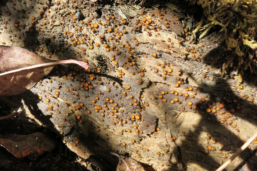
Golden City of Fungi near Harrington Knob in Leatherwood
Tom Walden–November 3, 2013

So, there it is. Kind of a potpourri of experiences from the treks. Hope you’ve enjoyed the pics and all, and I’ll be posting again when there’s more to reveal. Happy hiking till then!
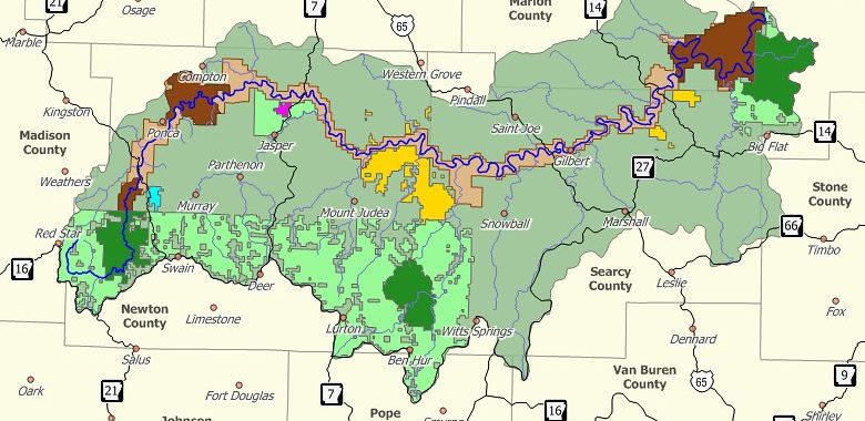
Trail Bagged from Spring Creed Road to Dillards Ferry/Hwy 14 Buffalo River Bridge

Been hearing about some of the newer Buffalo River Trail (BRT) located down southeast of Yellville, Arkansas. Heard it was a nice place for a hike, not too difficult, and had some great views of the Buffalo River. So, this past Friday I decided to give it a hike, and I found it was all it had been hyped to be.

To get there from Yellville, just take highway 14 south till you reach the bridge over the Buffalo River. The parking area and small picnic park and canoe landing around the bridge are known as Dillards Ferry according to the signs there and the National Geographic Trails Illustrated map of the Buffalo National River East I had with me. At the beginning of my quest, I had no idea that the trailhead started under and about 50 feet to the west of bridge. The trail is not marked on my map which was revised in 2009, and what I had read about it said the trailhead was actually on Spring Creek Road. So, instead of starting at Dillards Ferry, I traveled 4 miles on down the road southeast on 14 till I saw the signs pointing the way to Spring Creek Campground (3 miles in to the west). At around 2 miles down the road on the right is the trailhead marker pointing the way up the trail 6.1 miles to the Buffalo River bridge. There is no parking area at the trailhead, so I pulled as far off the road as I could get and headed north down the trail.

I might mention that the trail also takes off to the south just across the road from the part of the trail I hiked. There is no sign saying where or how far that part of the trail takes you, but I’ve heard rumors it heads south along the Buffalo River, bends with the Buffalo to the northwest, and ends at Maumee South campground. Looking at my map I would guesstimate the distance at between 5 and 6 miles. That will be a hike for another day.

Back to the hike I took. It had been some time since I hiked in the summer, so I had kind of forgotten about some of the less pleasurable aspects of hiking along the BRT in the warm season: cobwebs and horse flies in abundance. I’m just thankful I was in good enough shape to be able to hike most of the trail without having to open my mouth to breath. You see, I had forgotten my bottle of Tabasco, and cobwebs without a little spice are very bland.

That said, the rest of the experience was well worth the bothers brought by the webs and the flies. For one, the trail is probably in the moderate range of difficulty as BRT goes. Heading north on that section of trail, most of it is not challenging making for a relatively easy hike. There is one climb, though, that begins just about as soon as you cross Kimball Creek that takes you up the mountainside to the top of a little bluff. From there the trail meanders along mildly sloping uphill for a ways before gradually winding back down the the slope and hooking into an old road shown on my map as “Tie Chute Road.” At that point, I took a turn to the right, and about a half-mile later I was at the bridge/highway 14. On the way back to Spring Creek Road, there are the inevitable stretches of uphill, but the only one of any significance comes during the last mile to mile-and-a-half of the trip. There’s a stretch in that part of the trail that used to be an old road, and for about a quarter to a half mile there is a nice little uphill grade to traverse.

Image via Wikipedia


Almost all of the trail is well shaded by the canopy of the hardwoods, and the vegetation all along the way is lush. There are a handful of water crossings, but only one of those (Kimball Creek) resulted in me getting my feet wet. I’ll bet if I had wanted to take the time to explore up or down the creek, I would have found a place to cross on the rocks and could have easily stayed out of the water. Recent rains had caused the creek to be up, but where I crossed left me wondering how it had ever deserved the ‘creek’ designation. It was certainly not wide — about a two stepper — but just wide enough that I could not jump from one side to the other. Looking at the map, the creek itself is only about 2 miles from source to river — more of a drainage in my books.

The high points of the trek? Well, there were several nice views of the Buffalo from up high, and those views helped me gauge my route on the map. There was plenty of solitude; not another person was on the trail, but every once in awhile I could hear folks talking while paddling down the Buffalo in their canoes. Got to see a couple deer and one turkey, several other species of birds, a bunch of big snails inching their ways across the trail, butterflies of all sorts, and a very nice rain storm. I love to hike in the rain, especially when I am up high and can see out across large areas and watch the wind blow the rain into patterns as it falls. The downside of the rain was that it came to an end, and when it did and the sky cleared, the woods turned into a sauna.

Would I recommend this section of trail? You bet! If you like solitude, the sounds of nature, the lushness of the forest, and only moderately challenging terrain, this is a nice hike. Not too tough, not too easy, and certainly not boring. Oh, and did I mention, it is beautiful!

I’ll let you know how the other half of the trail is once I bag it, but till then, hike on and enjoy every breath of life you can take.

Phil

Wonderful Hike, Great Vistas, Very Special Friends — What Better Is There for a Once-a-Year Celebration

Image via Wikipedia


Opted not to go backpacking this weekend but, instead, to spend the day, a very special one for me, with two of the most important people in my life. What did we do? Well, we hit the woods for an easy hike that yielded great vistas, an abundance of photo ops, beautiful weather, and a chance to partake of nature’s ever changing pallet.

Last week it was a 4-miler from Richland Road to Woolum. Today, we traveled westerly out of Snowball, Arkansas, on the same Richland Road but parked it at McCutchen Gap, headed north, and then veered east till we stood on the bluff’s edge known as Rollins Point. Before us spread an expansive valley dotted with brilliantly green pastures, streams swollen by the previous night’s heavy rains, and the distant bluffs of the undulating Buffalo River.

The wild pear trees that, at a distance, mimicked patches of snow amid the still leafless spring landscape were in the early stages of shedding their white and putting on the green. Redbuds decided to join the show this week smattering the hillsides with their crimson and dark magenta brilliance. And all around it was as if green was doing its best to burst onto the scene.

Forgot to mention that earlier in the morning as we wound along 65 a little past Silver Hill heading south we spotted a herd of elk a good 20 strong. Though winter for this part of the world had been unusually harsh and long, the elk looked to be strong and well fed.

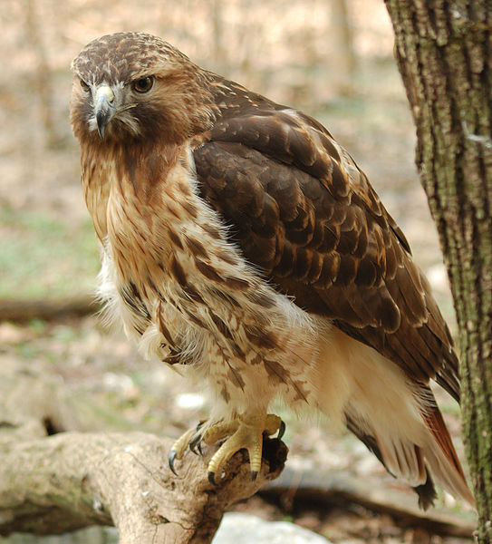
The hike itself — well, it was not all that long, perhaps a mile each way. A road leads up the mountain, and though it had been dampened well, it was firm. Once we reached what is some sort of tower, we were on a road cut across the mountain top allowing crews to maintain the line that provides electricity to the few inhabitants on to the west in Richland Valley. Short off-road/trail jaunts put us out on the edge of the rock outcroppings that had been our destination. We were up above the handful of vultures and red-tailed hawks riding the currents over the valley floor.

Now it was our intention at the start to work about a mile on north to Point Peter, and that we would have done had it not been for spending so much time taking in the beauty before us from Rollins Point. That’s just fine, though, because there will be another day and another hike. Always something to look forward to.

So, till next time, catch you out on the trail — Dr. Brown

A Wild and ‘Woolum’ Weekend Along the Buffalo

I’ve been so busy that I haven’t been backpacking since late November or early December of ’09. But, finally, this past Saturday and Sunday I got out for an overnight solo at Woolum in Buffalo River National Park.

Image by Christopher P. Bills via Flickr


It’s been so long since I pulled on the boots and hit a trail that I wasn’t sure the legs would cooperate. But to my surprise I wasn’t at all sore when I finished traversing the four miles from the trailhead to the spot where I decided to pitch camp. The trail? It was one I’d not been on before, though I’ve been at or through Woolum numerous times. The trailhead from where I started is located to the west northwest of Snowball, Arkansas, just under five miles along Richland Road and is marked by a single sign post pointing the way north to “Woolum — 4 miles.”

If you look at the new Trails Illustrated map of the Buffalo National River East, the trail is shown by a broken red line heading north from Richland Road. The map’s legend indicates that such a line connotes a ‘primitive horse trail.” Out in the woods, it is actually an old road, and the Park Service has done a real good job of keeping it cleared.

Richland Road itself is a gravel road that has been kept in reasonably good shape and is thus easy to drive with just a car despite the fact that about a 100-yard section of the road was taken out about a year or so ago by a landslide. It’s been repaired, but I will not be surprised if a real heavy rain moves the land some more at some point.

If you ever get a chance to hike in the Richland area, it won’t take long for you to realize how much the landscape has been altered through time by forces of nature causing the land to shift. In fact, a little over a year ago the Richland Creek Campground located in the Richland Creek Wilderness had to be closed when the side of a mountain collapsed and blocked the road less than two miles to the south of the campground along the east side of the wilderness area. I first learned of this event a year ago last Christmas while hiking the Ozark Highlands Trail (OHT). I was headed north along the segment of the trail that parallels the east side of the wilderness when suddenly I found myself entering a surreal landscape. It was a sight to behold, but then, that’s a topic for another time. Now back to the past weekend’s excursion.

The hike this past weekend along the primitive horse trail was relatively easy as the old road that is now a trail was constructed with little elevation change. The only real change in elevation begins about a half mile from the river resulting in the trail gradually descending 250 to 300 feet to Woolum on the Buffalo.

Initially, I had planned to camp in the big flat area across the river from Jamison Bluff in what was marked on the map as ‘The Pouroff.’ On the map it looked like I would be able to hike from where the trail ended to The Pouroff by bushwhacking along what appeared on the map to be a narrow stretch of terrain between the river and the foot of the mountain to the south. What I found, though, was that there was no such narrow stretch. The river was up due to recent rains, and I quickly learned that the only way I was going to get from where I was at the trail’s end to where I wanted to be was either by swimming the river or by going up and over the mountain in front of me. Neither option looked that great to me, so I opted to turn around and follow the trail back to the west and down into the flat area lying along Richland Creek. It was there I pitched camp among the hawthorns.

Hawthorns have thorns, lots of thorns, lots of big thorns. Setting up the tent required special attention be given to the ground under the tent. Specifically, segments of thorn-laden branches have broken and fallen to the ground through time, and the grasses have done a good job of growing over and hiding those needle-sharp surprises. Needless to say, overlooking one of those while pitching the tent would have left me with a flat sleeping mat and, perhaps, a little punctured pride. Fortunately, the only poke I got while searching through the grasses for the errant thorns was in my finger — twice.

The day had been beautiful and relatively warm — somewhere in the upper 60’s. So, once camp was set, I headed over to Richland Creek to wash off and fix a meal. While I was cleaning up, I noticed the billowy white tops of some clouds peaking over the mountain tops to the west. I knew rain was in the forecast, but I didn’t pay much heed to the weather. I was more focused on getting cleaned up and deciding what to eat. However, no sooner had I started cooking some grub than I heard what sounded like thunder in the distance. I looked back over my shoulder and saw that the puffy white clouds that dotted the sky only minutes earlier had turned into a dark, foreboding mass. I did my best to ignore what looked and sounded like a storm brewing by keeping my focus on what was to become dinner, but just as suddenly as the clouds had changed in the sky, drops of rain began dampening me and everything around. Another look over my shoulder was all I needed to realize that all the denial in the world was not going to stop the inevitable. Another small clue was that the wind had gone from being mild to attention getting.

I decided it was time to leave the food cooking on low flame and get back to the tent to secure the rainfly. With that task accomplished, back I flew to my meal and backpack. I grabbed my rain jacket and pants from my bag while getting pelted by some wind-driven drops of moisture, slipped into both as quickly as I could, and no sooner did I get them on but the sky opened and down came the deluge. By that time my meal had cooked to my satisfaction, so with my back to the wind and rain, I sat and ate with water pouring from the hood of my jacket into my pot of food. It was great! What energy! Lightning, thunder, wind, and rain undulating all around. By the time I finished eating, the rain had subsided, so I cleaned up my mess, filled my water bladder, and headed to my tent to get in a little reading. As I was crawling into the tent, lightning lit up the sky, thunder clapped, and the rain poured once again.

There’s something about tents and heavy rains that have a relaxing effect on me, and after reading for what may have been about an hour, I must have nodded off to sleep. All I know is that it was dark when I came to, so I decided to call it an evening. What a nice night it was with a goose or two honking their way across the sky at times, the soothing sounds of the water rolling down the creek, the winds and occasional rains smattering the tent, and the hoots of owls as they talked back and forth through the darkness. There was even the loud screech of some animal in the woods nearby that occurred soon after I heard the first haunting song of an owl. I’ll never know what it was that made what sounded like a call of desperation, but I couldn’t help wondering if a squirrel asleep in its nest suddenly fell prey to an owl. Actually, there was one long screech followed several seconds by a second, much shorter screech that my imagination told me was possibly the last dying call of that fated squirrel. After that, all was quiet but for the wind and the sound of rushing, rolling water in the distance.

By morning, the sky had calmed, so I decided to eat, drink my tea, and pack before the heavens offered another surprise. I was on the trail about an hour after getting up and about. On the way in there had been several stretches of trail that made walking in water almost mandatory, but on the way out, much of the trail was like a miniature creek. I have to say there is something to be said for boots that are as waterproof as they are touted to be.

Well, about an hour and a half later I was back to the car and on the road to home thinking about the fresh elk tracks I had seen on the trail and the deer I had scared up the morning before, the snake I almost stepped on while walking along water rushing from a hollow near camp, and the turkey I heard earlier that morning while packing to leave. It wasn’t long, though, and my thoughts turned to the next adventure. After all, there has to be a way down into ‘The Pouroff.”

Till next time, catch you out on the trail…Dr. Brown

Welcome to a Thru-Hiking Experience in Northwest Arkansas

Image via Wikipedia

I’d like to take this opportunity to welcome you all to the Ozarks of northwest Arkansas. If you’ve never been here and want to check out the hiking and backpacking in these parts, you’re in for a very memorable experience. To those of you who have put down some trail around here, you know just what I’m talking about.

The Ozarks is a great place for day hikes as well as for multi-day backcountry excursions. What few people know, though, is that there is a thru-hike of about 233 miles that starts about an hour’s drive southwest of Harrison, Arkansas. Yes, it’s a little-known and well-kept secret.

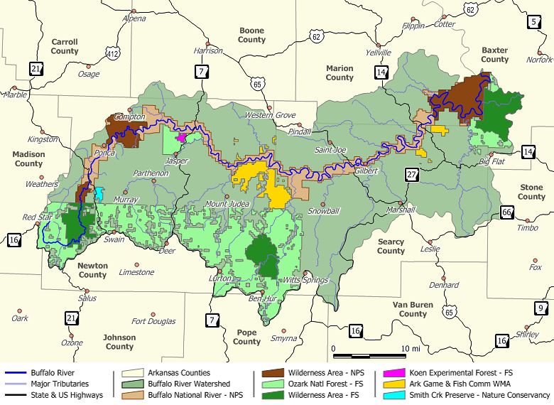
Now, if you’re grabbing your maps and looking for this trail, you’ll find yourself wondering why your map doesn’t show it. The simple truth is that about 200 miles of this trail is comprised of two maintained trails that you can find on maps. However, those trails are linked by unmarked horse trail that you won’t find on any map. The two maintained trails are the Ozark Highlands Trail (OHT) and the Buffalo River Trail (BRT), and it is the Boxley trailhead to the BRT that lies about an hour to the southwest of Harrison.

You can find the Boxley trailhead if you travel south on highway 43 out of Harrison. It’s a drive that gets increasingly scenic as you head into Newton county and wind through Compton and on to Ponca. Soon after leaving Ponca, you’ll enter Boxley Valley where along with an occasional glimpse of the Buffalo River it is not uncommon to spot herds of elk. A few meandering miles into the valley is the intersection of highways 21 and 43, and it is there that 43 ends. Somewhere between two and three miles further south on 21 is the Boxley trailhead parking area on your right. Once you’ve parked your vehicle, head back across the highway and you will find the trail’s starting point.

Once on the trail, you’ll travel in a north, northeasterly direction through Buffalo River National Park back to Ponca. You’ll exit the Ponca area by hiking under the highway 74 bridge that crosses the Buffalo. In less than an hour the trail sneaks on above Steel Creek campground toward Kyles Landing, and after you’ve crossed the road going down into the Kyles campground, you have put behind you the toughest hiking on the BRT. Next on the agenda are the Erbie and Ozark campgrounds with the BRT culminating at Pruitt on highway 7.

Pruitt is the beginning of 30+ miles of trail that will test your skills as a backpacker, for it is this section of trail that is unmarked and subject to change by floods. This is a part of the Buffalo River where groups of horse riders do there thing, and it is by their efforts that the trail from Pruitt to Woolum exists.

To get yourself on this section of trail, you will have to leave Pruitt headed north on highway 7 and walk on across the bridge spanning the Buffalo. On your right just after you’ve completed the bridge crossing is a little parking area where you’ll find a trail and a road that both cut back to the south and down to Lower Pruitt Landing. The Landing is a stopping and starting point for folks canoeing the Buffalo. What you’ll be looking for once you’re there is the parking area for the Mill Creek Trail. As you’re standing there reading the information about the trail, look off to your right, and you’ll find the starting point for your unmarked journey. Follow that trail across Mill Creek north along the Buffalo until it crosses the river. Having crossed the river, your true adventure begins.

One thing to know about this section of trail is that, for the most part, it stays very close to the river, usually within 100 yards. Another important piece of information to have is that this is not a hike to undertake when the Buffalo’s kicking it up from heavy rains. As it is for sections of horse trail all along the Buffalo, so too it is for this — you will be crossing the river many, many times. So, a word to the wise, attempt this thru-hike only during relatively dry times.

Now, typically, when you leave dry land and cross the river, the trail on the other side is easy to find, but there are a couple points between Pruitt and Hasty (the first seven miles of trail) when this may not be true. If you encounter this problem, remember to keep your head on straight, search for a bit up and down the bank, and you’ll find the trail once again. Yes, this stretch of trail will test your skills as a navigator. If all goes well you will find navigable trail twisting back and forth past Carver and Mount Hersey and on to the link with the OHT at Woolum. Remember, this is unmarked trail that does not always readily present itself, so if you are not an experienced backpacker, this may not be a thru-hike for you.

From Woolum on, the trek is relatively easy. Just cross the river on the upstream side of Richland Creek, and you’ll be on the road that will take you off in a northwesterly direction for close to a mile before hooking left to the south through Richland Valley for several miles to the well-marked spot where the OHT heads into the woods leaving civilization behind.

The OHT leg of this journey takes you through country that differs in many ways from that which you experienced during the first 70+ miles of your trip. This is not to say that the scenery is any less splendid, for that it is not. This trail is well marked and maintained, and it has something for everyone regardless of your level of experience as a backpacker. You will cross numerous streams, partake of breath-taking vistas, and get to hike through some of the finest forests the Ozarks have to offer. Yes, as you hike along the OHT, you will be blessed with all sorts of awe-inspiring and challenging moments before you take those last steps to your destination at the Lake Ft. Smith State Park trailhead.

So, there you have it — a sketch of what is, at this time, the longest on-trail thru-hike in the Ozarks of northwest Arkansas. I will apologize, though, for one oversight. I am sorry for insinuating that your hike will end when you hit the Lake Ft. Smith trailhead. For all I know, you may be so psyched about what you have just been through for the past several days that you will be off on what will be the first leg of your yo-yo.

Till next time, I’ll catch you out on the trail — Dr. Brown